

It is a difficult task to observe the weather and predict extreme meteorological conditions. The majority of sites are slightly more accurate than fortunetellers at forecasting rain or any other precipitation. However, in the event of a hurricane, the incorrect signal may cause human casualties. The recent cyclone “Sitrang”, which hit the coast of Bangladesh, is real proof of this.
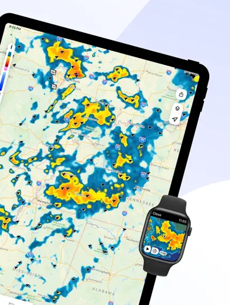
Most forecasting resources use data that is updated every 6 hours. Meteorological radar provides the most accurate forecast. Devices every 5–10 minutes scan the space within a radius of 200–400 km around and identify precipitation zones, their direction, and type (rain, hail, snow).
Thanks to technology today everyone can get an accurate short-term forecast by downloading the live hurricane tracker.
The RainViewer program was created to track weather radar data and provide the most precise climate conditions. The program collects data from 1.2 thousand meteorological radars around the world and is able to predict rain, thunderstorms, and snowfall an hour ahead with an accuracy of 55% to 90%. Users can download the mobile phone app from AppStore. The program is accessible in 90 countries around the world.
How the app works
RainViewer initially gathers and examines data from weather radars on the precise location of precipitation zones, their intensity, and their speed of movement in order to predict climate conditions. Then it combines the data into one sizable image, performs analysis, and creates a forecast for the next 90 minutes. The high productivity of RainViewer allows you to process more than 600 images every 5 minutes.
The application can give a long-term forecast: in the free version — up to 7 days, in the paid version — up to 14. To use the program on a computer, simply download the application from GooglePlay.
RainViewer is most often used by pilots, farmers, bikers, photographers, and just people who don’t want to get wet.
Key Benefits of the Program
Users of RainViewer can follow storms, rain, and snowfalls from any location. A feature enables the addition of preferred locations and the receiving of rain alerts.
Other development benefits include:
- Weather radar map. It enables everyone to keep track of a rainstorm’s path and other meteorology changes during the previous 48 hours, as well as its current state and a forecast for its type over the next 90 minutes.
- Precipitation forecast map. Using RainViewer, which creates a 90-minute rainfall map animation from more than 1000 meteorological radars, it is simple to plan the day.
- Schedule of precipitation. Shows the precipitation intensity for the next hour in the specified region.
In addition, the application allows you to share the radar animation with friends, colleagues, or team members. This is available in GIF and mp4 formats. There is a function of publication on the Facebook page, Snapchat, and Twitter.
Article Submitted By Community Writer